Walking and Hiking
Walking or hiking Vermont trails and mountains makes a great vacation
You will find many wonderful walks and hikes for all abilities in Vermont’s Green Mountains, Lake Champlain Islands, and throughout the state’s towns. Browse the listings below for the right walk for you, your family, and children. Walking is a romantic getaway, too.
Resources:
The Long Trail and the Green Mountain Club
The 272-mile Long Trail was built in 1910 by the Green Mountain Club. The Trail has sections for beginner, average, and expert hikers. Trails are rated as easy, moderate, and difficult, and by other factors. The Long Trail follows the Green Mountains and crosses Stratton Mountain, Mount Mansfield, Jay Peak, and Camels Hump, with a side trail into the Northeast Kingdom. It coincides with the Appalachian Trail for 100 miles. The Green Mountain Club operates a visitor center on Route 100 in Waterbury Center, providing information, merchandise, access to the Short Trail, a picnic area, and toilets. Please carry in and carry out all belongings. 802-244-7037.
Cross Vermont Trail
The Cross Vermont Trail will be a 90-mile path connecting towns from Lake Champlain to the Connecticut River. Thirty miles of the trail are open to the public. Maps and guides to the trail are posted online. Existing parts of the trail go near Wells River, Newbury, Montpelier, Middlesex, Berlin, Waterbury, Duxbury, Williston, and Burlington. 802-498-0079
Preparing to Walk:
Getting Ready:
- Always take a map and a compass.
- Mountain weather changes quickly! Check the weather forecast. If a storm is coming, get off the summit.
- Weather at the peaks is colder, windier, and wetter. Dress with a layer close to your body for wicking sweat from your skin, a layer for warmth, and a top layer like Gore-Tex to block wind.
- Wear sturdy hiking boots and good socks.
- Take more liquid than you think you’ll need. Also, power bars, string cheese, bananas, raisins, nuts.
- Take a first-aid kit, a flashlight, a pocketknife, and a whistle.
On the Trail:
- Treat all water by boiling, filtering, or chemically treating.
- Carry out all of your trash (including biodegradable items like orange peels).
- Use the privy if the site has one. Otherwise, dispose of waste at least 75 paces away from water.
- Give wild animals plenty of room.
- Build a fire only in an established fire pit.
- If you’re staying overnight, use the lodges or designated tenting sites.
40 listings



Chittenden, VT
Mountain Top Resort
195 Mountain Top Road 802-483-2311Woodlands, meadows, trails make this secluded mountain resort a paradise for hikers
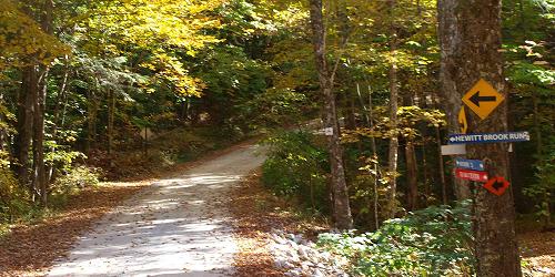
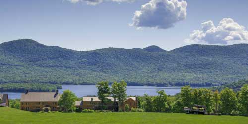
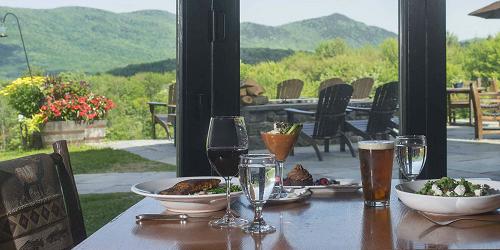
You could say that the Mountain Top Resort, perched on top of a central Vermont mountain with over 700 private acres of woods and meadows, is a hiker’s paradise. The four-season resort includes 60 miles of wooded trails, manicured meadows and quiet country lanes. Ask for a picnic lunch to be packed for you before you head out to enjoy the sights and sounds of nature at its finest. The trails link up with access to the popular Long Trail. Or, opt for a leisurely stroll down a country lake to the lake. After your hike, consider a luxurious massage in the on-site spa, a few relaxing minutes in the sauna or a good soak in the year-round hot tub or heated in-ground swimming pool.
Burlington, VT
Intervale Center Trails
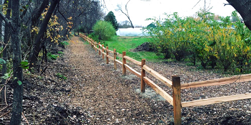
180 Intervale Road 802-660-0440This farm- and food-loving organization declares a mission of strengthening community food systems. Among its many offerings is to welcome people to the outdoors. The Intervale is open to the public every day. Recreational trails wind along the Winooski River to the Ethan Allen Homestead. They are used for biking, walking, and jogging, In winter, three miles of cross-country ski trails are groomed for classic and skate skiers. Bicyclists: Intervale roads are part of Cycle the City, a self-guided loop that winds through Burlington and the Ethan Allen Homestead, up to the University of Vermont and downtown Burlington. - Trail Map (PDF)
Parking: Visitors to the Intervale Center may park at two public parking lots off of Intervale Road, or in the lot across the street from Gardener’s Supply, at 128 Intervale Road.
Manchester, VT
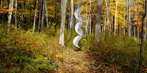
Trails at the Southern Vermont Arts Center
930 Southern Vermont Arts Center Drive 802-362-1405The Southern Vermont Arts Center loop trail leads to many hikes. You may follow the loop to the Equinox Pond for a relaxing afternoon, or make the day of it and hike to the summit of Equinox Mountain, to enjoy panoramic views of Manchester and the surrounding area. See the heading Sculpture Park & Trails at this page.
Manchester, VT
Equinox Preserve
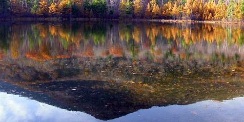
Slopes of Mount Equinox 802-366-1400The Equinox Preserve consists of over 914 acres on the slopes of Mount Equinox in Manchester, VT.
Entry Points. There are two main entry points to the Equinox Preserve lands. The green entrance gate at the designated parking to the Red Gate Trail is the principal entrance. To reach it, drive west on West Union Street (just south of Burr & Burton Academy on Prospect Street in Manchester Village). Turn right at the end of paved portion toward the town’s water tank. The gate is a short distance below the Red Gate Trail. A second entry is through the Southern Vermont Arts Center, during business hours. - Trail Map (PDF)
Hinesburg, VT
Gillespie/Copp-Welch Trails
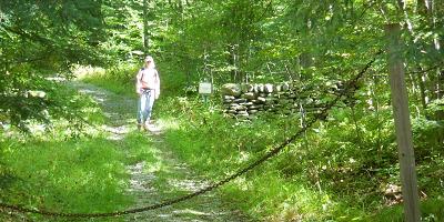
Off Gilman or Lewis Creek RoadEasy-to moderate level foot trails on a 3-mile loop a few miles southeast of Hinesburg Village center. Trails pass through forest and fields. Good for hiking, cross-country skiing, snowshoeing, and horseback riding. Part of the Hinesburg Area Recreational Trails system, managed by the Hinesburg Town Trails Committee.
The Trail: Parked dirt, grass and meadow. Loop trail. Three miles.
Access: via Gilman Road or Lewis Creek Road.
Manchester, VT
Hildene Walking Trails
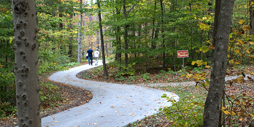
1005 Hildene Road 802-362-1788Hildene, the Lincoln Family Home, is a historic house and also a place for wonderful walks. Twelve miles of trails on 400 acres begin and end at the Welcome Center. The trails include a variety of landscapes from woods to meadows. The sanctuary is a home for pollinators; bees and butterflies and ground nesting birds. On the lower part of the property at Dene Farm, the trails lead to a working farm.
Hours: Open year-round; daily; 9:30 a.m.-4:30 p.m.
General Admission: $6-$23, depending on age.
Pittsford, VT
Pittsford Trail Network
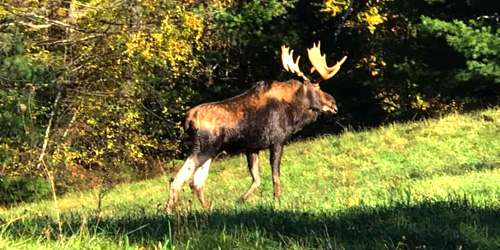
Near Route 3 and Route 7This trail network around the town of Pittsford is maintained by volunteers and is open year-round for walking, bird watching, jogging, snowshoeing, hiking, and cross-country skiing. Trails are well-designated and they cross open fields, wander along rivers and waterfalls, and move through woodlands. This website has many excellent printable or online maps to help you choose a trail for your walking needs. - Trail Map 1 (PDF) - Trail Map 2 (PDF)
Randolph, VT
Allis State Park
284 Allis State Park Road 802-276-3175Rustic camping; picnicking, hiking; free day use; pets allowed
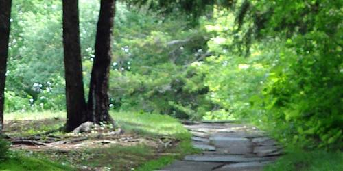
This park is for rustic camping, walking and hiking on trail loops that offer a tough workout. Views are magnificent: sweeping views of Killington, Pico, Mount Ascutney, Camel’s Hump and Mount Mansfield, and the White Mountains of New Hampshire. Bear Hill was once a fire lookout location.
An interesting nature trail (PDF), accompanied by a detailed online guide, describes trees and other plants and wildlife. - Interactive Campground Map (PDF)
Windsor, VT
Mount Ascutney State Park
1826 Back Mountain Road 888-409-7579Great for hiking & hang gliding; pets permitted
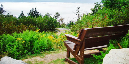
The park entrance is 550 feet above sea level and a paved road travels to the summit at 2,800 feet. Four trails run from the base of Mount Ascutney to the summit. They are joined by a trail that follows the ridge. The Weathersfield Trail passes Cascade Falls. The Windsor Trail passes a small waterfall. The Brownsville Trail follows a logging road and old granite quarry. The paved Mount Ascutney Parkway reaches the summit. A side trail leads to an observation tower at the summit. - Trail Map (PDF)
Killington, VT
Gifford Woods State Park
34 Gifford Woods Access Road 802-775-5354Good hiking and access to Appalachian Trail; pets permitted, but not in cabins
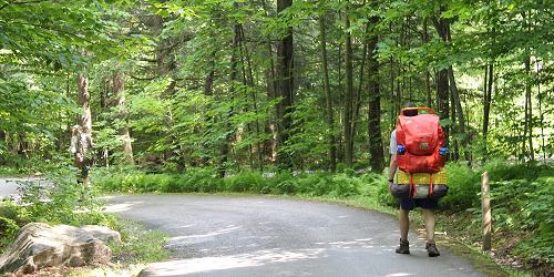
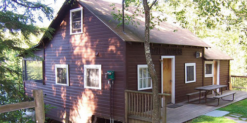
Two major hiking trails meet at Gifford Woods State Park: The Appalachian Trail and the Long Trail. Green Mountain National Forest and Coolidge State Forest, both nearby, also offer loop hikes. Wonderful views from the Deer Leap Mountain trail and beautiful waterfalls on Thundering Brook Trail. - Summer Trail Map (PDF) - Winter Trail Map (PDF)
Hubbardton, VT
Half Moon Pond State Park
1621 Black Pond Road 802-273-2848Family and kid-friendly camping park has lots of trails; good trail map
The park has a very large trail system that includes short walks to full-day hikes. - Trail Map (PDF)

East Dorset, VT
Emerald Lake State Park
65 Emerald Lake Lane 802-362-1655Fine camping, swimming, paddling, fishing, walking and hiking; motor boats prohibited
Located on Emerald lake and near the Long Trail, the Appalachian Trail, and trails on Dorset Mountain, this park is a favorite for hikers. - Trail Map (PDF)
VT
Bennington Town Walks
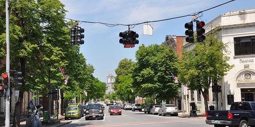
Bennington is a beautiful and classic Vermont town, where it is fun to stroll and simply look at the houses and parks and businesses. The Bennington Area Chamber of Commerce has created two self-guided walking tours (Trail Map [PDF]) that pass some local landmarks of distinction, as well as ordinary places where life bustles forward among old paths and foundations.
One of the tours passes the Bennington Monument, The Catamount Tavern, the Old Academy, the Village Lion, the Walloomsac Inn, the Old First Church, and the Bennington Museum. The other tour, through downtown, passes St. Francis De Sales Church, the Putnam House, Bennington County Courthouse, the Old Blacksmith's Shop, the Old Stone Mill, Bennington Potter's Yard, the Blue Benn Diner and the Henry Bradford Mill.
Weston, VT
Weston Village
The central Vermont Village of Weston is a picture of small-town Vermont simplicity and loveliness. The center of the village is the Green, also called Farrar Park, on Route 100, where a gazebo is brightly lit at Christmas. Walking southward on Route 100, you may pass the Weston Village Store, the Village Green Gallery, the Vermont Country Store, and the Farrar-Mansur house museum (built in 1797). Walking northward, you will see the Weston Playhouse and Maple Grove Cemetery.
Bennington, VT
One World Conservation Center Reserve
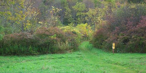
413 US Rte 7 South 802-447-7419This Reserve, a former dairy farm just a mile from the center of Bennington, is about 100 acres of open meadow, wetland and woodland. From the parking lot, a main trail crosses a meadow and passes through a wetland before it links to a cluster of trails beyond Brook. Trolley Trail follows an abandoned trolley line, with views of the wetland and the surrounding hills. Woodland trails wind through the hillside to the Birch Overlook, an old kettle pond. - Trail Map (PDF)
Rupert, VT
Merck Forest and Farmland Center Trails
3270 Route 315 802-394-7836Many trails range from easy to difficult; something for every walker and hiker
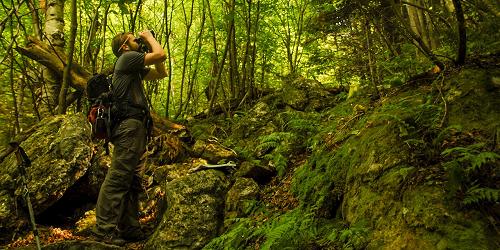
Merck Forest and Farmland Center is an educational organization that teaches and demonstrates innovative management of forest and farmland. The public may visit the farm every day of the year from dawn to dusk. People may visit the farm, explore the forest, walk on 30 miles of trails or stay overnight in a rustic cabin or lean-to. There is no admission fee. Merck Forest Trails are open for hiking, horseback riding, snowshoeing and cross country skiing.
Groton, VT
Groton Forest and Kettle Pond Trails
Park HQ and Nature Center, 44 Stillwater Road (off Route 232) 802-584-3822Several easy hikes of 0.25 to 3 miles; good for kids
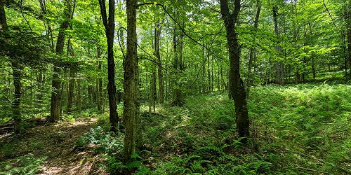
Groton State Forest encompasses Kettle Pond, Big Deer, Ricker Pond, and New Discovery State Parks. The forest has many miles of marked trails for hiking, biking, horseback riding, snowmobiling, snowshoeing, and cross-country skiing. Below are a few trails in the forest:
Kettle Pond Trail and Kettle Pond Portage Trail: This moderate walk goes around a secluded lake. (3 miles)
Owls Head Trail: An easy walk to a scenic vista of Lake Groton, Kettle Pond, and the Green Mountains. (1.5 miles)
Montpelier Wells River Rail Trail: Good place for walking, bicycling or horseback riding. Gradual, 7-mile grade through the state forest. (7 miles) -
Charlotte, VT
Mount Philo State Park
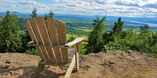
5425 Humphreys' Road 802-425-2390Park on a mountain top has magnificent views; camping; hiking; pets allowed
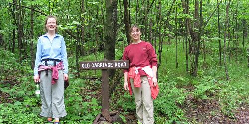
This park atop Mount Philo has magnificent views. There are hiking trails from the mountain base to the summit. The main trail enters the woods off the park road and proceeds uphill to House Rock. One-half mile up the main trail, an offshoot trail goes to the right to Devil’s Chair, a huge boulder. The summit ledges and picnic area are a short, steep climb. Use blue blazes. - Trail Guide (PDF)
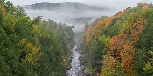
Quechee, VT
Quechee Gorge State Park Trail
Visitor Center at 6054 Woodstock Road (U.S. Route 4) 802-295-6852Four hiking loops of 1 to 2 miles with moderate rating; good for kids
This walk, doable by almost anyone, gives fabulous view of Quechee Gorge, sometimes called the Grand Canyon of the East. Also near the walk and the gorge is Quechee Gorge Village with lots of shopping for adults and children. Great place to browse and pick up vacation mementoes.
The walk alongside Quechee Gorge is one to two miles and easy, except for a mild elevation gain. The walk gives you a view of the Gorge and then takes you along the gorge, past waterfalls and Dewey's Mill Pond. Start at the visitor center and follow the spur trail behind the building to the main trail. Turn right, walking upstream. At the Route 4 overpass, notice a good view of the gorge from the highway bridge. Continue upstream on the trail; you will see a dam, waterfalls, and a neck of land that runs between Ottauquechee River and Dewey's Mill Pond.
Season is mid-May to late October.
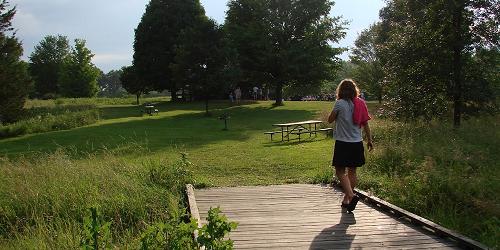
North Hero, VT
Knight Point State Park
44 Knight Point Road 802-372-8389Easy walk; one mile; good for kids
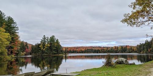
This easy, one-mile trail skirts one point of Knight Point State Park, which is located at the southern end of North Hero Island, one of the Lake Champlain Islands. The trail passes through woodland and along the shore, offering views of the lake and lots of boat traffic. The Lake Champlain Islands are the closest image of Heaven you are likely to find anywhere. Twisty roads through rural areas and small towns offer beautiful views of the lake and distant mountain tops on all sides. - Interactive Map (PDF)
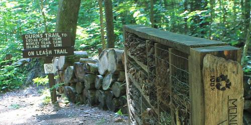
Colchester, VT
Niquette Bay State Park Trails
274 Raymond Road 802-893-5210Five easy or moderate walks; 0.25 to 1.50 miles; some good for kids
This state park is perched on the shore of Malletts Bay. It is an easy drive along Routes 89 or 7 to Burlington and Shelburne, to the south, or along Route 2, out to the beautiful Lake Champlain Islands, for day trips. Both places have many great attractions for adults and kids.
The park’s trails offer three loops and a variety of hiking combinations ranging from 0.6 miles to 3.5 miles. Most are rated moderate difficulty; the Burns and Allen Trails are rated easy. Views of the lake, ridges, and distant mountains. Parking is next to the park office at the entrance to the property. Pets are welcome; proof of rabies vaccination is required. The Burns, Muhley, and Island View trails are designated off-leash areas. - Interactive Map (PDF)
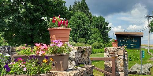
Lake Elmore, VT
Elmore State Park’s Fire Tower and Balanced Rock Trails
856 VT Route 12 802-888-2982Mix of easy and moderate walks 0.5 to 1.25 miles; some good for kids
There is a variety of trails to explore, from easy to moderate to difficult. Mountain Brook Nature Trail is approximately 0.5 mile in length (about 30 minutes for a leisurely stroll). Printed brochure describes plant and wild life. Beaver Trail is 0.50 mile and easy. Passes through woodlands and wetlands.
Two trails in the park are rated moderate to difficult, and not for children. Elmore Mountain Trail (also called Fire Tower Trail) is 1.25 miles, ending at a fire tower with spectacular views of the Presidential Range in New Hampshire to Jay Peak and Mount Mansfield in Vermont. The Balancing Rock Trail is 0.5 miles through woodlands and along ledges, leading to a cool boulder balancing on its tip. - Mountain Brook Nature Trail Guide (PDF)
Underhill, VT
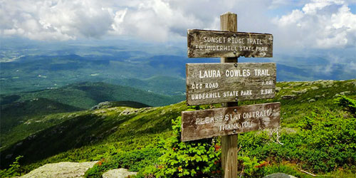
Underhill State Park Trails
352 Mountain Road 802-899-3022Trails are moderate to difficult, to the summit of Mount Mansfield; not for kids; entrance road does not accommodate RVs, trailers, large buses
Underhill State Park is 2,000 feet above sea level on the slope of Mount Mansfield, the state’s tallest peak. From this park four hiking trails lead to the summit ridge of Mount Mansfield. The Sunset Ridge trail is the most popular.
Vermont’s Long Trail crosses the summit ridge and provides many hiking loops on both slopes of the mountain. The ridgeline is above tree line, and plants in this area are of the alpine tundra varieties. The ridge offers views of Lake Champlain and the mountains of New York. - Interactive Trail Map (PDF)

Stowe, VT
Smugglers' Notch State Park Trails
6443 Mountain Road 802-253-4014Moderate to difficult trails in high mountains; not for children
Smugglers' Notch is a narrow pass through the mountain with 1,000 foot cliffs. Today, it is the home of peregrine falcons and it is heavily used by hikers and ice climbers. The entrance road is passable by vehicles only in summer. A well-loved trail up the mountain is the Long Trail, which can be reached from the Notch. The Long Trail passes Elephant’s Head and Sterling Pond, a beautiful and serene mountain lake. The Hell Brook Trail is a shorter but much steeper route to the summit of Mount Mansfield. - Trail Map (PDF)
Island Pond, VT
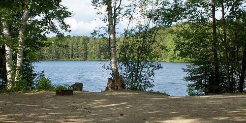
Brighton State Park Nature Trails
Brighton State Park, 102 State Park Road 802-723-4360Easy loops of 0.25 to 0.50 mile, with guide to natural sights; good for kids
Brighton State Park lies in the heart of Vermont’s Northeast Kingdom, north of the interesting town of St. Johnsbury. This is the wildest and most isolated area in Vermont, rich in legends of Indians and loggers. It is the go-to place for serious outdoor sportsmen. A designated Northeast Kingdom Nature Trail online guide is a great accompaniment for nature lovers. All trails have woodland views and are easy, from 0.25 to 0.50 mile. They are called the Red Pine, Main, Shore trails, and the Loggers Loop. Fun for nature watchers of all ages. - Trail Map (PDF)
Waterbury Center, VT
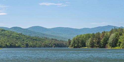
Peninsula Nature Trail at Waterbury Center State Park
177 Reservoir Road 802-244-1226Waterbury Center State Park lies on the Waterbury Reservoir, a quarter mile off VT Route 100. The park is open from Memorial Day to the second week of October. This walk is about one-half mile and easy. Good for kids. - Nature Trail Map (PDF)
Guilford, VT
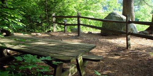
Fort Dummer State Park Trails
517 Old Guilford Road 802-254-2610Easy 0.5 to 1-mile walks; great views; good for kids
By their very nature, old forts provide great vistas. Fort Dummer has three nice, easy trails. Also, this park is just south of Brattleboro, a fun place for visit, shop, stroll, and dine for adults and children. - Trail Map (PDF)
Sunrise Trail: A 1-mile loop trail across level and slightly sloping ground. Views about halfway along the trail, which is wooded the whole way. Sunset Trail is a 0.5 mile loop trail on the western side of the park, starting near the entrance and passing through the play field. The remains of the Boyden Farm, dating form the 1880s, can be seen along this trail. Farm relics include stone walls, a small shed and farmhouse.
Broad Brook Trail: This 0.5 mile trail descends from the campground to a popular swimming hole on Broad Brook. The trail is steep in sections, and therefore is a much more strenuous hike than the other trails.
Wilmington, VT
Molly Stark State Park Trails
Molly Stark State Park, 705 Vermont 9 802-464-5460One easy and more moderate walk, 0.20 to 1.70 miles; easy walk is good for kids
This state park is located off historic Route 9, a very beautiful mountain road crossing the state from Brattleboro on the east to Wilmington on the western. Both towns are full of fun, dynamic things to do and see and places to eat and shop, for adults and children. A walk on Molly Stark P Park trails makes a nice half-day outdoor adventure for families and others.
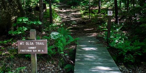
From the park entrance, follow signs to the easy and kid-friendly Nature Center Spur Trail for a 20-minute walk of 0.20 mile or the moderate-rated Mount Olga Trail walk, which is 1.70 miles and 1.5 hours of walking, to a fire tower.
Castleton, VT
Bomoseen State Park Trails
22 Cedar Mountain Road 802-265-4242Selection of moderate and easy trails, 0.75 to 1.5 miles; good walk for kids
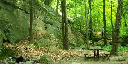
Bomoseen State Park is in the Taconic Mountains on the shores of Lake Bomoseen. These mountains are the slate-producing region of Vermont, and the park contains several quarry holes and colorful slate piles as reminders of this period. Several hiking trails go through woodlands and pass ponds and provide great hiking and wildlife-viewing opportunities. Not far from this park is the town of Rutland, with attractions for families, especially related to the quarrying industry.
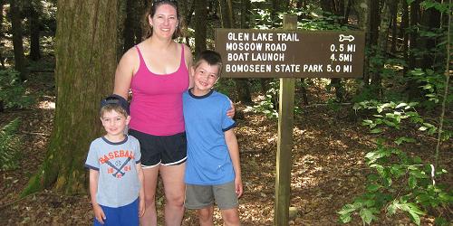
Trails include the Bomoseen Hiking Loop of 1.5 miles and the Glen lake Trail of 4.5 miles, both of moderate difficulty; and the Slate History Trail and the Daniel Coffey Memorial Trail, both 0.75 miles and rated easy. - Trail Map (PDF)
Brandon, VT
Branbury State Park Trails
3570 Lake Dunmore Road 802-247-5925Mix of easy and difficult trails including a waterfall; two trails offer hiking for kids
Branbury State Park is next to the Green Mountain National Forest and the Moosalamoo Recreation Area. There are over 70 miles of trails in this region of mountains and lakes traversing the western slopes of the Green Mountains.
Popular trails are the Falls of Lana trail, which leads to a series of cascading falls; Rattlesnake Point, which has breeding peregrine falcons and panoramic views of Lake Dunmore; and Silver Lake, a hike to a small, scenic mountain lake. - Trails Map (PDF)
Woodstock, VT
Mount Peg
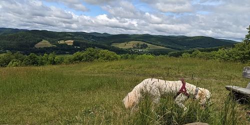
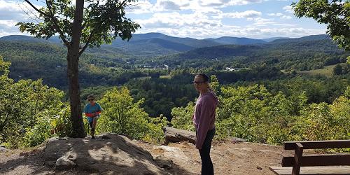
Parking and trail head at Maple and Golf streetsThis sweet trail starts just outside the beautiful town of Woodstock. The trailhead is steep at first as it moves through the woods, but it evens out to a gentle grade. Views at the summit include Ottauquechee River Valley, Mount Tom, Billings Farm and Museum, Pomfret Hills, and Killington Mountain. Round trip is about 2.5 miles.
Directions: Leaving the center of Woodstock, walk or drive down Court Street between Courthouse and Woodstock Inn. At the end of Court Street turn left and then make a right on to Golf Avenue. Continue on Golf Avenue to Maple Street. At Maple and Golf Streets see parking on left. Trailhead is to the left off the driveway. - Trail Map courtesy of Woodstock Inn (PDF)
Outside of Woodstock, VT
Trails of Mount Tom
at Marsh-Billings-Rockefeller National Historical ParkThe hill in the center of town on the banks of the Ottauquechee River can be reached by three trails:
The Faulkner Trail -- The walk is about 30 minutes for the average hiker and provides a magical view of Woodstock. Near the top the trail gets steep, narrow and a bit tricky for about 100 yards.
River Street Cemetery Trail -- A less traveled trail with fewer markings. This trail will take you past the Swift Water Girl Scout cabin and up to the Link Trail. Or you may bear right to walk to the trails at the Marsh Billings Rockefeller Historic National Park.
Prosper Road Trail Head -- This is an easy walk on wide carriage roads. There is parking. Maps are often available.
Woodstock, VT
Eshqua Bog Natural Area
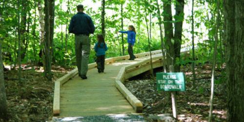
Garvin Hill RoadWheelchair-accessible boardwalk; plentiful lady's slippers in June
Eshqua Bog Natural Area is a botanical garden and home to the lady’s-slipper orchid. Eshqua Bog Natural Area has a wheelchair-accessible boardwalk with several viewing platforms . The property is managed by The Nature Conservancy of Vermont and The Native Plant Trust (formerly the New England Wildflower Society).
Directions: From I-89 take Exit 1 to for Route 4 west toward Woodstock and Rutland. Drive 10.4 miles to where Route 4 makes a sharp bend to the right. Turn left on Hartland Hill Road. Drive 1.2 miles and bear right onto Garvin Hill Road. Drive another 1.2 miles and look for the Nature Conservancy parking area on the right. The well-marked trail is on the right, just beyond the pull off.
Manchester, VT
Lye Brook Falls Trail
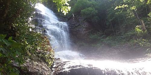
The trail, marked with blue blazes, enters the 15,680-acre Lye Brook Wilderness following Lye Brook. Using old logging railroad grades and old woods roads, the trail travels up a steady gradual slope. Downed trees from a 1995 cyclonic storm and a few small stream crossings make some of the trail difficult to pass. A spur trail at 1.8 miles, on the right, leads to the 125-foot high Lye Brook Falls, one of the highest in Vermont. Slippery rocks make the falls dangerous; climbing the falls is not recommended.
Directions to the trailhead: Starting in the town of Manchester, from Route 7A, turn east on Depot Street (Routes 11/30) and drive for about one half mile, turning right on Richville Road. At the post office, turn left on East Manchester Road and cross beneath Route 7. After the underpass, turn right on the Lye Brook Falls Access Road (the sign might say Glen Road, but there is another sign indicating Lye Brook Falls access) and follow it to the end and the park.
Brattleboro, Dummerston, Newfane, Townshend, Jamaica and South Londonderry, VT
West River Valley Trail
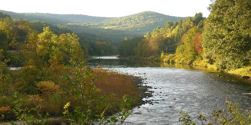
Various access points36-mile scenic all-season trail following a former railroad bed through the West River Valley. The two sections of the trail link to Brattleboro, Dummerston, Jamaica, Newfane, South Londonderry and Townshend. Parking for the lower section is available US Route 5 and Spring Tree Road. - Lower Section Trail Map (PDF) - Upper Section Trail Map (PDF)
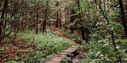
Brattleboro, VT
Brattleboro Retreat Trails
Off Route 30Trails on the Brattleboro Retreat property have been used by local people since the 1800s. In 2006 and 2007, the Retreat and the Windham Foundation partnered in a project to revitalize the trails. There are several ways to enter the nine-mile trail network. Trails are open to year-round for hiking, cross-country skiing, showshoeing, mountain biking and horseback riding. No motor vehicles. Pets are welcome on leash. Please pack out what you bring in. Open year-round for free. - Trail Map (PDF)

Williston, VT
Whales Tails Walking Path
30 Community Drive - Technology ParkThis easy, 1.7-mile loop travels around the 13-foot-tall Whale Tails sculpture, a familiar sight off of I-89 south of Burlington. The granite sculpture, created by Jim Sardonis, was a finalist for a museum front in Anchorage, Alaska. The sculpture's title, "Reverence," is meant to evoke the fragility of the planet.It now occupies the property of Technology Park and is the centerpiece of a walking path. Nice walk for photographers; Vermont whales are rare and these two fellows are very popular. Photo Credit: Michael Weizenegger

Westmore, VT
Mount Pisgah Trails
Route 5AWestmore and Mount Pisgah are a short drive from the town of Burke. You will find great hiking trails here. The summit has two overlooks, one with a view of the Passumpsic Valley and the southern White Mountains, the other of Bald Mountain and the northern White Mountains.
Trailhead and parking: The trailhead and parking for the South Trail are on Route 5A about one-half mile south of the southern end of Willoughby Lake. The climb for the South Trail is 1480 feet. From the summit you can connect to the North Trail of Mount Pisgah.
The trailhead and parking for the North Trail are along Route 5A one mile south of Long Pond Road and about two and one-half miles north of the southern end of Willoughby Lake. The North Trail offers a climb of 1530 feet with a two-mile hike. From the summit you can connect to the South Trail of Mount Pisgah.
The trailhead for the East Trail is in Westmore about 1.8 miles up Long Pond Road. The East Trail offers a climb of 900 feet with a two-mile hike. The trail connects to the Mount Pisgah North and South Trails. - Trail Map & Add'l Info

from Westmore or East Charleston, VT
Bald Mountain Trails
Off of VT Route 5A or Mad Brook RoadTwo hiking trails can take walkers to the summit of Bald Mountain - Mad Brook Trail and Long Pond Trail. Long Pond Trail begins just east of the Long Pond fishing access on Long Pond Road, two miles east of Vermont Route 5A. The trail has blue blazes and it travels through hardwood forest and crosses some small streams. Trail distance is two miles and the ascent is 1,250 feet. Mad Brook Trail approaches Bald Mountain from the north, beginning at Mad Brook Road in East Charleston. A small parking area is available. The trail follows a gravel road and passes a private dwelling and then enters an open meadow, followed by forest. Trail distances is about three miles with a 1,415-foot ascent. - Trail Map & Add'l Info
Stowe, VT
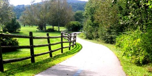
Stowe Recreational Path
Along Mountain Road (Route 108) 802-253-2264Total Length: 5.3 Miles
The Stowe Recreation Path is an easy walking trail that winds through the Village of Stowe and crosses the West Branch River. The 5.5-mile one-way path (not loop) is paved and easy to reach. It is open all year, for walking, running, cycling, Nordic skiing and snowshoeing. Stay out of the groomed ski tracks during the winter. Dogs allowed on leash.
Access Points: Lintilhac Park behind the Stowe Community Church on Main Street; Chase Park across from Stony Brook Condominiums on Luce Hill Road; Thompson Park off Route 108 across from the Percy Farm Corn Maze; Topnotch access off Brook Road, just past Topnotch Resort on Route 108.