State and Local Parks
Central Vermont's state and local parks make room for outdoor activities
21 listings
Windsor, VT
Mount Ascutney State Park
1826 Back Mountain Road 888-409-7579Great for hiking & hang gliding; pets permitted
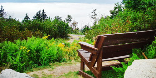
This park is recommended for camping, hiking, and views. It has 39 tent or trailer sites and 10 lean-to sites. Two restrooms with plumbing and hot showers. There is a sanitary dump station for RVs (no hookups) and two picnic areas.
The park summit is 2,800 high. Hang gliding takeoff spot. A stone hut has two grills that use charcoal; a picnic tables. Park is located on the Connecticut River Byway. - Campground Map (PDF) - Trail Map (PDF)
Open: mid-May thru mid-October, 10am - Sunset.
Ludlow, VT
Camp Plymouth State Park
2008 Scout Camp Road 802-228-2025One of Vermont’s top parks for paddling; beach; boat rentals; horse camping; walking trails
Recreational gold panning is allowed in Buffalo Brook. There is a group camping area and horses are allowed in this area. The area has lean-tos, pit toilets, tie-off station, a manure bin, and a field for activities.
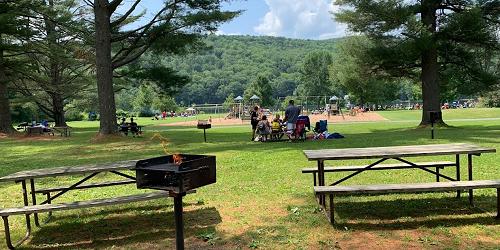
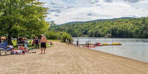
There is a large picnic area, play area, sandy beach, horseshoe pits, concession, and boat rentals and four furnished rental cottages. A large enclosed picnic shelter with a kitchen and two smaller pavilion-style picnic shelters are for rent. - Campground Map (PDF) - Okemo State Forest Hiking Guide (PDF)
Open: Memorial Day thru Labor Day, 10am - Sunset.
Randolph, VT
Allis State Park
284 Allis State Park Road 802-276-3175Rustic camping, picnicking, hiking; free day use; pets allowed
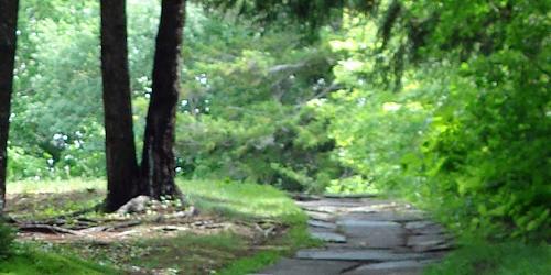
This park is loved by people who want to get away from noise, activity, and convenience. The park, on an old farm, is on Bear Hill, where views allowed lookouts to watch for forest fires. Peaks visible from Allis State Park are Killington, Pico, Mount Ascutney, Camel’s Hump and Mount Mansfield.
There are 15 tent sites and 8 lean-to shelters; restrooms with hot showers; picnic area and shelter; firewood for sale; hiking. Drinking water is available. Limited trash service is available. The log pavilion is for rent. It seats 100 people and has electricity and a restroom. Also: grills, fire places, and picnic tables. Hiking loops are nearby too. - Interactive Campground Map (PDF)
Open: Memorial Day thru Labor Day Weekend, 10am - Sunset.
Websterville, VT
Barre Town Forest and Millstone Hill
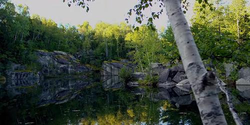
44 Brook Street 802-479-9331Over 100 years ago, Millstone Hill in Websterville (adjacent to Barre) was the site of more than 75 small granite quarrying operations, producing granite for monuments throughout the nation. During the 20th century, quarries consolidated and smaller operations closed. Quarries filled with water and the woods grew back. This community forest for the Town of Barre is on 355 acres of former quarry land. The town forest is part of a 70-mile walking and mountain biking trail network. Trails take you among the quarries, with great views and lots of evidence of the region’s industrial history. A Touring Center is located in a historic general store at 34 Church Hill Road in Websterville. A fleet of Jamis bikes is available for rentals. - Trails Map
Plymouth, VT
Coolidge State Park
855 Coolidge State Park Road 802-672-3612Beautiful views; rustic character; camping; hiking trails
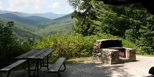
Coolidge State Park is near Plymouth Notch, the birthplace of President Calvin Coolidge and loved for its magnificent views. The wooded campground has 36 lean-to sites and 26 tent or trailer sites; four bathrooms with hot showers; a large picnic shelter; a nature center, a play area, volleyball, and a horseshoe pit. There is a sanitary dump station for RVs, but no hookups. An open pavilion with electricity, grills, fireplaces, and picnic tables is available for rent. There are miles of hiking trails and opportunities to see wildlife. - Interactive Campground Map (PDF) - Coolidge Range Trail Map (PDF)
Hubbardton, VT
Taconic Mountains Ramble State Park
321 St. John Road 802-786-0060Walking, wildlife viewing
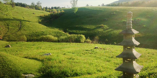
This is an undeveloped state park on land donated to the state in late 2016. It is in the shadow of Mount Zion. There are walking trails and a beautiful Japanese garden. No visitor facilities. Pets are welcome. Open: Year round, 10 a.m. to sunset. - Eastern Trail Map (PDF) - Western Trail Map (PDF)
Groton, VT
Boulder Beach State Park
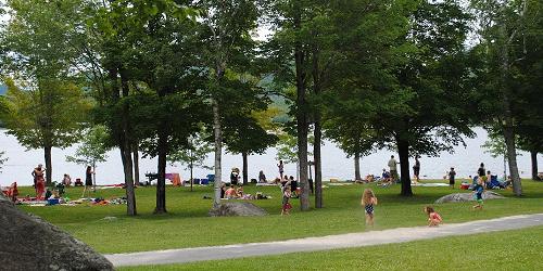
2278 Boulder Beach Road 802-584-3823This park is located on the shore of Lake Groton. The day use area has 75 shaded picnic sites with tables and grills. There is 200 feet of beach and swimming area, a car top boat launch, play area, shelter with group facilities, three large parking lots, and a concession stand. All rest rooms have lavatories and flush toilets. Day use fees charged. This park is part of Groton State Forest. The Groton Nature Center is nearby and serves all the state parks in the Groton State Forest. - Interactive Map & Guide (PDF)
Marshfield, VT
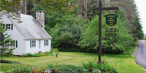
New Discovery State Park and Osmore Pond
4239 VT Route 232 802-426-3042This campground has 46 tent/trailer sites and 15 lean-tos. Seven sites allow horse campers. Bathrooms with hot showers. A dump station is available; no hookups. There is a play area and miles of hiking trails. Swimming is at Boulder Beach State Park.
Osmore Pond is a rustic pond; motorboats are not allowed. The pond has four campsites, a picnic shelter with restrooms. All picnic sites have a picnic table and a fireplace with a grill. Drinking water is available. Flush toilets are in the picnic shelter. There is a day use fee.
Osmore Pond is stocked with brook trout. Canoes and rowboats are available for rent. Hiking trails to Big Deer and Little Deer summits and Hosmer Brook Trail are accessible from the Osmore Pond Trail. This park is part of Groton State Forest. - Interactive Campground Map (PDF)
Groton, VT
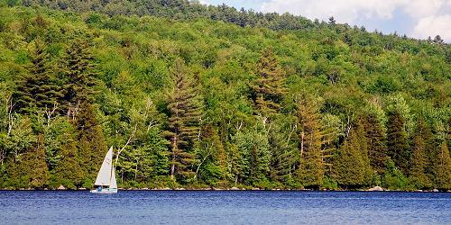
Ricker Pond State Park
18 Ricker Pond Campground Road 802-584-3821This campground has 27 tent/trailer sites, 23 lean-tos, 5 cabins and a waterfront rental cottage that sleeps up to 5 and comes with a canoe. Bathrooms wit hot showers for a fee. A sanitary dump station is available, but no hookups. There is a swimming beach, boat launch, shelter, and access to miles of hiking trails. - Interactive Campground Map (PDF)
Groton, VT
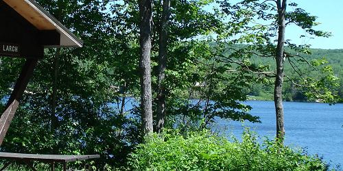
Stillwater State Park
44 Stillwater Road 802-584-3822This campground is located on Lake Groton. The park includes a campground with 60 tent/trailer sites and 19 lean-tos. All bathrooms have hot showers. There is a sanitary dump station available, but no hookups for RVs. There is a swimming beach, boat launch/dock facility, play area and miles of hiking and multiple use trails in the adjacent state forest. The Groton Nature Center is nearby. - Interactive Campground Map (PDF) - Groton State Forest Nature Trail Map (PDF)
Groton, VT
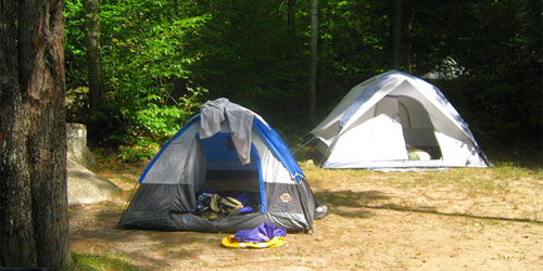
Big Deer State Park
1467 Boulder Beach Road 802-584-3822This campground has 23 tent/trailer sites and 5 lean-tos. The bathroom has hot showers ($). A sanitary dump station is available at Stillwater, but no hookups. There's easy access to the Groton Nature Center, Boulder Beach, and miles of hiking trails. - Interactive Campground Guide (PDF)

Waterbury Center, VT
Waterbury Center State Park
177 Reservoir Road 802-244-1226One of VT’s top five parks for paddling and boating; also, swimming, fishing; no pets
Waterbury Center State Park lies on a 90-acre peninsula of Waterbury Reservoir within Mount Mansfield State Forest. It is popular for boating, fishing, swimming, and picnicking. The park has picnic sites, tables, grills, a swimming beach, a nature trail, trailer boat ramp, boat rentals, concession area and restrooms. A wheelchair-accessible trail includes two fishing platforms. The reservoir allows fishing, paddling, swimming, motor boating, jet skis, and water skiing. Open: Memorial Day-Labor Day; day hours, 10 a.m.-sunset. - Peninsula Nature Trail Map (PDF)
Hartford, VT
Quechee State Park
6800 Woodstock Road (U.S. Route 4) 802-295-2990Walks along a magnificent glacial gorge; camping; pets permitted
The centerpiece of this park is the fantastic Quechee Gorge -- Vermont’s Little Grand Canyon. The Ottauquechee River flows through the gorge about 165 feet below Route 4. Next to the gorge, on Route 4, is Quechee Gorge Village, a fun place to shop for Vermont souvenirs.
The park contains 45 tent or trailer sites and 7 lean-to sites; two bathrooms with showers; and a sanitary dump station. Large enough for RVs. No hookups. Picnic area has a pit toilet and a hiking trail along the gorge. - Interactive Campground Map (PDF) - Trail Map (PDF)
Open: Memorial Day thru mid-October, 10am - Sunset.
Hubbardton, VT
Half Moon Pond State Park
1621 Black Pond Road 802-273-2848Good park for camping, hiking, boating, paddling, fishing; no day use; pets allowed
Half Moon Pond Park is on wooded land in a sheltered basin wrapped around Half Moon Pond. This is a camping-only park; no day use.
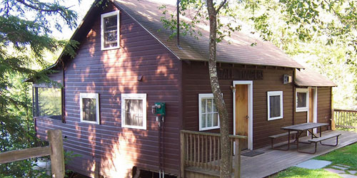
The campground offers tent and lean-to camp sites and furnished cabins. Flush toilets, hot showers for a fee, and a dump station are provided. Pets are permitted, but not in cabins or cottages.
The park has a large trail system and two swimming beaches. Rowboats, kayaks, canoes and pedal boats are for rent (no motor boats allowed). The pond has excellent fishing for bass, panfish, and perch. - Trail Map (PDF) - Campground Map (PDF)
Open: Memorial Day thru Columbus Day
Addison, VT
D.A.R. State Park
6750 VT Route 17 West 802-759-2354On bluffs overlooking Lake Champlain; campground in meadow; water sports; bird watching
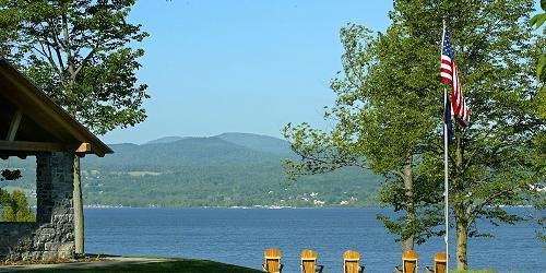
This is a quiet park on the shore of Lake Champlain. Good for both daytime and overnight visits. The park has a large, open campground, grassy picnic areas, and stone pavilion, which may be rented. Good location for bird watching. There are 70 sites including 24 lean-tos located in a meadow and under a stand of large trees. Flush toilets, hot showers, and a dump station are provided. Picnic area located on a bluff; pavilion for groups. Boating, fishing, sailing, and swimming are popular in Lake Champlain. Season & Hours: Memorial Day-Labor Day; day use hours, 10 a.m.-9 p.m. Pets allowed except in picnic area. - Interactive Campground Map (PDF)
Killington, VT
Gifford Woods State Park
34 Gifford Woods Access Road 802-775-5354Good hiking and access to Appalachian Trail; pets permitted, but not in cabins
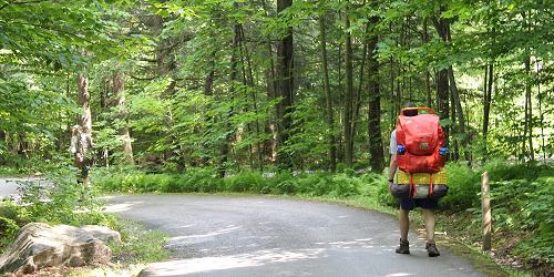
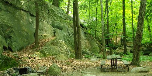
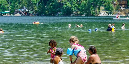
The Appalachian Trail and the Long Trail meet at Gifford Woods State Park. Green Mountain National Forest and Coolidge State Forest, both nearby, also offer loop hikes. Wonderful views from the Deer Leap Mountain trail and beautiful waterfalls on Thundering Brook Trail. - Summer Trail Map (PDF) - Winter Trail Map (PDF)
Brandon, VT
Branbury State Park
3570 Lake Dunmore Road (Route 53) 888-409-7579Popular for hiking and swimming; pets allowed in day use area and campsites
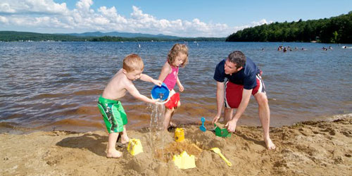
Branbury State Park is on the shore of Lake Dunmore and at the base of Mount Moosalamoo. Camp sites includes 24 tent sites in a wooded area and 17 tent sites in a grassy field. Campgrounds have flush toilets, hot showers, and a dump station. Swimming and picnicking are popular from the sandy beach.
Pets are allowed only in the day use area and campsites. There are lots of hiking trails and mountain biking trails nearby. Fishing and boating is on Lake Dunmore. You can rent canoes, kayaks, rowboats, and pedal boats. - Interactive Campground Map (PDF) - Hiking Trail Map (PDF)
Open: mid-May thru Columbus Day, 10am - Sunset.
Castleton, VT
Bomoseen State Park
22 Cedar Mountain Road 802-265-4242Good for camping, swimming, fishing, boating w/ rentals; pets allowed in campground
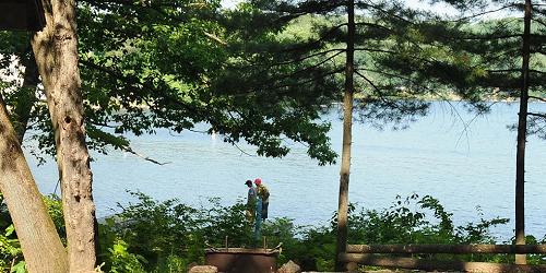
Bomoseen State Park is in the Taconic Mountains. It covers 2,000 acres around Glen Lake. Forested land that includes the camping area that is Half Moon State Park. The campground contains 66 campsites, some in the woods, and some on the lake shore; flush toilets, hot showers, and a dump station. A large picnic pavilion is available for rent. Electricity, grills, picnic tables, restrooms, and wheelchair path.
There is boating and fishing in Lake Bomoseen and Glen Lake. The park has a swimming beach and a picnic area, snack bar, and rentals of canoes, kayaks, rowboats, and pedal boats. There are several hiking trails (PDF). - Interactive Campground Guide (PDF)
Open: Memorial Day thru Labor Day, 10am - Sunset.
Springfield, VT
Wilgus State Park
3985 CT River Road (Route 5) 802-674-5422On Connecticut River; popular for paddling, canoeing, kayaking; campsites; cabins with WiFi
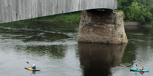
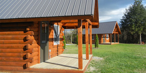
Four cabins with WiFi, 17 tent sites and 6 lean-to sites on the Connecticut River. A bathroom with running water and hot showers. There is a picnic area, and three lean-tos in the group area. Canoes and kayaks are available. A trailer sanitary station is by the ranger's quarters. A small picnic shelter can be reserved for groups. Pets are allowed, except in cabins. Day use access to the Connecticut River and the Pinnacle Trail hike. - Interactive Campground Map (PDF) - Okemo State Forest Map & Guide (PDF)
Open: Late April thru Columbus Day, 10am - Sunset.
Vergennes, VT
Button Bay State Park
118 Button Bay State Park Road 802-475-2377Camping on Lake Champlain; great views; guarded pool; trails; nature center
Button Bay Park is on a bluff overlooking Lake Champlain. The open meadow camping area has 73 sites and 2 cabins. Flush toilets, hot showers, and a dump station are provided. The park has a picnic area, play area, and a swimming pool with lifeguards. Canoes, kayaks, and rowboats are for rent. Button Point Natural Area is a hardwood forest with trails and a Nature Center. Visitors may rent a large pavilion for up to 300 people with electricity, grills, picnic tables, and a bathroom. - Interactive Campground Map and Guide (PDF) - Lake Champlain Byway
Open: Memorial Day thru Columbus Day, 10am - Sunset.
Poultney, VT
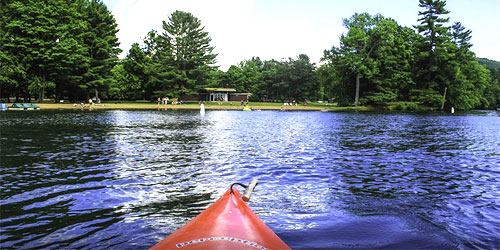
Lake St. Catherine State Park
3034 VT Route 30 South 802-287-9158Lake side camping; beach; boating, fishing; boat rentals; pets allowed except in day use area
The park is on the shore of picturesque Lake St. Catherine. There is a 61-site campground with 50 tent and trailer sites and 11 lean-to sites, flush toilets, hot showers, and a dump station; a nature center; two sandy beaches; a large grassy field with a playground and a snack bar; rowboat, canoe, kayak and pedal boat rentals; a boat launch for fishing or water skiing on the lake. A short hiking trail goes to an overlook of Birdseye Mountain. Anglers fish for panfish, bass, rainbow and brown trout, yellow perch and northern pike. - Interactive Campground Map (PDF) - Rail Trail (PDF)